Tectonic time-lapse: One billion years of Earth’s history in 40 seconds
It’s not often you can click play and watch deep time unspool before your eyes.
An international team of scientists including experts from the University of Adelaide has just released the first full tectonic plate reconstruction of the last billion years – spanning nearly a quarter of the Earth’s existence.
Full-plate tectonic animation of the last billion years. White areas represent oceanic crust, green areas are modelled continental lithosphere, and blue areas are additional present-day continental crust. Spiked lines are subduction zones; blue lines are mid-ocean ridges; black lines are transform boundaries. Ma = Millions of years ago. 1 second = 25 million years. Credit: Merdith et al. 2021 (Earth Science Reviews).
It’s mesmerising: like ill-fitting jigsaw pieces, bits of continents slam together and morph into supercontinents, break apart, and then crash back together in new formations – with each second of the video leaping forward 25 million years.
According to Alan Collins, a geologist from the School of Physical Sciences - who is part of the research team with University of Adelaide colleague Dr Morgan Blades - this is going to help us understand how complex life began.
It’s only in the last billion years of the Earth’s 4.5-billion-year history that life worked out how to form cells, combine them, and make complicated creatures.
“We have a million hypotheses of why this happened, but absolutely none of them are scientific at the moment,” Professor Collins says.
“We have no models for what the world looked like.”
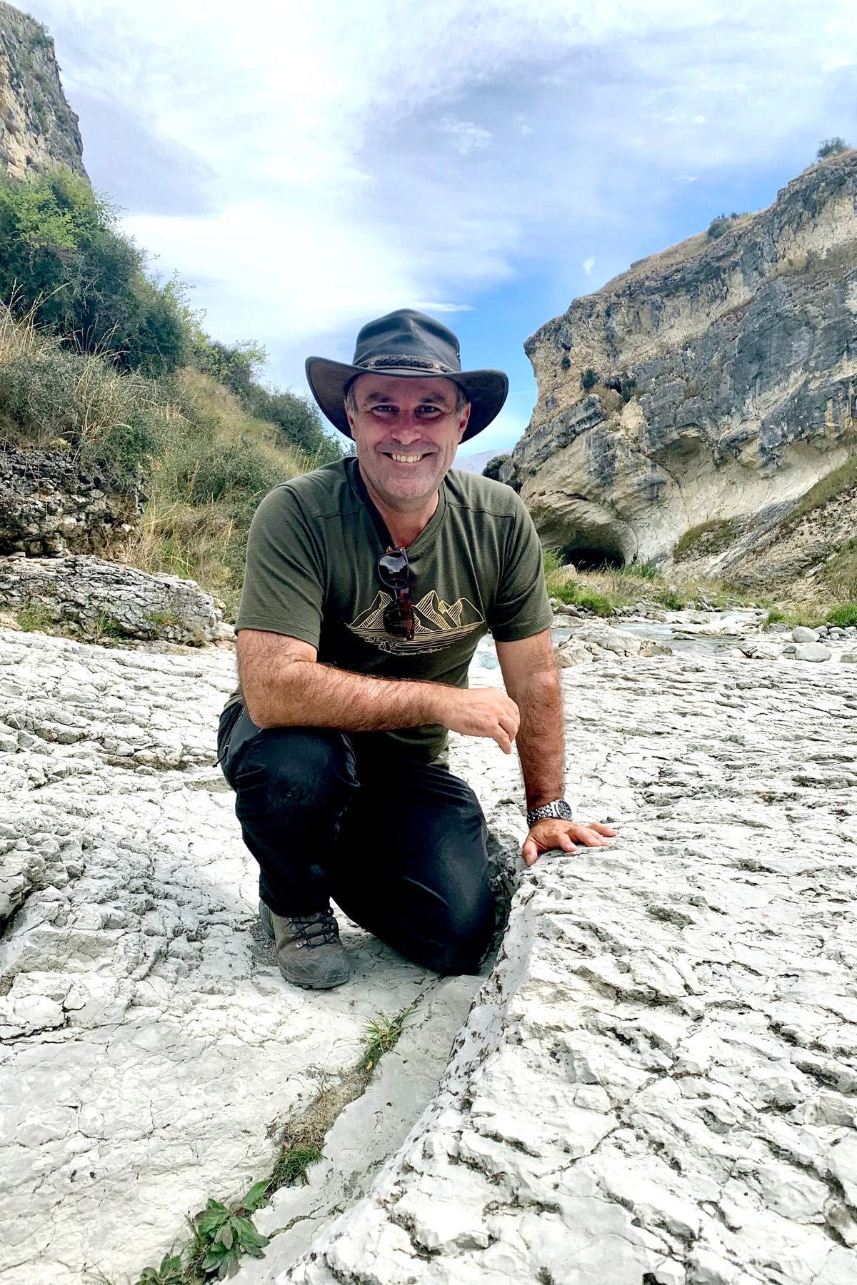
Professor Alan Collins - who was recently awarded the SW Carey Medal by the Geological Society of Australia - in the field, leading an honours field trip at Cave Creek in New Zealand in 2020. This location is close to the Australia Plate margin that runs right through New Zealand. Image: Fionnuala Sheehan
Though scientists know that many of the elements required by life – like the phosphorous in our DNA – came from the deep Earth and must have been hauled up to the surface at some point, we have no big-picture understanding of how the Earth’s many complex, interrelated systems have evolved over time. This lack of framework means we can’t quantify or test models about the Earth’s climate or the evolution of life.
But this reconstruction – soon to be published in the journal Earth Science Reviews and led by Andrew Merdith from France’s Université of Lyon – could be the answer.
Researchers from France, Canada, China and Australia pulled together decades of geological data to reconstruct the planet’s tectonic pulse, then input it into a piece of software developed by the EarthByte research group, at the University of Sydney.
Called GPlates, the software is like GIS – a system for representing data related to positions on the Earth’s surface – but reaches back in time in an attempt to map the world on the grandest possible scale of history: where the plate boundaries were and how they evolved, how continents collided and how they ripped apart.
“This really is an astonishing result,” says Louis Moresi, a geologist from the Australian National University who was not involved in the research.
Professor Moresi explains that it’s extremely difficult to figure out what the world looked like in the past, particularly because the seafloor doesn’t last very long: it’s always being recycled into the deep Earth at subduction zones.
“That means we don’t actually have any plates as old as a billion years – nothing more than about 200 million years – everything is gone five times over!” he says.
“So there is a lot of indirect evidence strung together to make this possible.”
Previous models of plate movement were mostly based on the idea of continental drift by looking at continental rocks. The location of certain rocks at the time of their formation can be determined by looking at their “frozen in” signature of the Earth’s magnetic field. From this signature, paleomagnetic geologists can figure out their original latitude – even if their home continent has drifted thousands of kilometres since.
But this is a tricky technique. These “time machine” rocks need to contain radioactive materials in order to accurately be dated. It’s also difficult to find old specimens that haven’t been deformed, melted or reset.
Plus, since it’s hard to figure out where the ancient oceans were, previous plate reconstructions were missing a massive chunk of data.
Instead, this new research focused on plate boundaries and working out how they shifted over time.
“The plates are continually shoving the continents around and crashing them into each other,” Professor Moresi explains. “That means the geological record is full of evidence of old plate boundaries and the past actions of plates.
“We have billions of years of the continental record – for example, old mountain belts leave traces in the rock and sedimentary record even after being eroded – so we have evidence for plates from a billion years ago even though they are long gone into the mantle.”
This is what the team was looking for: they dug up, scrutinised and synthesised research from over the past few decades, including figuring out where mountains were (indicated by the places continents have hit each other), where ocean basins were (which is where the continents rifted and spread apart), and the bathymetry of the ocean (which is the ocean’s depth relative to sea level; it has all sorts to do with the locations of mid-ocean ridges, and the subduction zones, and trenches).
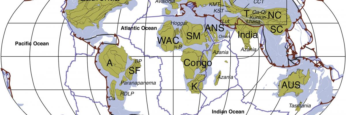
Distribution of continental crust, ocean basins and plate boundaries in the plate model at 0 Ma (current day). Credit: Merdith et al. 2021 (Earth Science Reviews).
“It’s really just data mining on this whole-Earth scale,” Professor Collins says – and when they pieced it together, they produced “a horrendous, four-dimensional jigsaw puzzle: three dimensions on the surface, and then it goes through time as well”.
In 2017, the collaboration produced a similar full-plate reconstruction stretching 1–0.5 billion years ago, a span of time that encompasses some of the most exciting moments in the history of Earth, including massive climate swings and the explosion of animal life.
Now, the team have added the most recent 500 million years, bringing us all the way to modern day.
This work is important not just for pure geological understanding, but to give context to the incredible changes that have swept across the Earth over the past billion years.
Starting around 720 million years ago, two massive ice ages engulfed the planet in glaciers from pole to equator in an event dubbed Snowball Earth. When we emerged from the ice, protozoa – the first true animals – evolved. By 635 million years ago, the first complex multicellular organisms were flourishing in warm and shallow seas, and then 500 million years ago life exploded with diversity, giving rise to the ancestors of all animals we know today.
Climate events like Snowball Earth are thought to be interrelated with both plate tectonics and the evolution of life, in an intricate web of cause-and-effect.
For example, large-scale weathering of mountain chains may have plunged us into an ice age. Global glaciers would have ground down mountains and sent a flood of nutrients out to sea, which may have caused bacteria to bloom and churn out oxygen, changing the composition of the atmosphere to the one we are familiar with today – the atmosphere that life as we know it evolved within.
“Without plate tectonics, guaranteed we wouldn’t be here,” Professor Collins notes.
This kind of global plate reconstruction can help scientists begin to understand – and quantify – the complex relationships between the Earth’s system.
It’s just one thread in the pursuit of an all-encompassing Earth systems theory, asking some of the broadest questions in Earth science: how did the planet come to be? Why does it move and breathe like it does? How did life arise?
But to more accurately answer these questions, this model needs to be a lot more detailed: right now, it’s largely 2D, showing the size and position of the plates on the Earth’s surface over time. The next step is to build upwards, figuring out where mountains were at what time, and how long the mountain ranges were at different altitudes, as this is key to understanding their influence on climate.
The model will also undoubtedly change as it is subject to scrutiny, feedback and collaboration by other researchers around the world, who will hopefully help expand the dataset and refine the map.
“I would imagine the more recent part of the model is very robust, [while] the more ancient parts will be less well constrained,” Professor Moresi notes.
Professor Collins readily admits that there was a fair bit of guesswork involved in producing the model – which is why it’s never been done before.
“No one’s put their neck out enough to get it cut off by trying to produce these models – because everything on them is controversial,” he explains. “For every interpretation of every rock in the middle of Africa or whatever, somebody else will have a different age, or think it was formed in a different tectonic setting.”
But even building this model is a step forward, because they have put it into a format that other researchers can work on. The software, GPlates, is intentionally user-friendly and open source. Anyone can come in and disagree – push a date back a few hundred million years, or interpret a piece of data as a rift margin rather than a subduction zone – then play around with the model based on their expertise.
This model is very much a first step, Professor Collins says, “but you’ve got to start somewhere”.
There’s also potential to reach back and reconstruct the Earth even more distantly in time, to two billion years ago and beyond.
“There’s so much we don’t know about,” Professor Collins says.
“Geology is really young – plate tectonics as a theory is only 50 or 50 years old, so we’re still working out all these things about the modern earth, let alone how it was 300 million years ago.
“But the beautiful thing is, the evidence is all there. It’s all in the rocks around the continents – it’s just about learning new ways to read them.”
Further reading
- Extending full-plate tectonic models into deep time: Linking the Neoproterozoic and the Phanerozoic, Earth Science Reviews.
- This article, written by science journalist Lauren Fuge, is republished with permission from Cosmos. View the original article.
- The Royal Institution of Australia has an education resource based on this article.